Floor Size (sq ft)
3rd 1,888
2nd 2,385
1st 2,370
Ground 1,964
Lower Gnd 3,052
Total 11,659
Information:
This modern self-contained buildings boasts excellent natural light throughout, generous ceiling height and a private courtyard. The available offices are generally open plan and arranged over the lower ground, ground, first, second and third floors. The space is available to let as a whole or on a floor by floor basis.
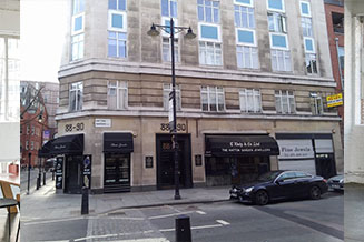
Charterhouse Buildings is located to the south of Clerkenwell Road (A5201) immediately to the west of where it intersects with Goswell Road (A1). Charterhouse Buildings is a no-through road just to the north of Charterhouse Square. Numerous bus routes run along Clerkenwell Road and Goswell Road and there are many cafes, shops and pubs all within easy access.
Available by way of a new effective full repairing & insuring lease/s for a term by arrangement. Any lease/s will exclude the Security of Tenure and Compensation Provisions provided by the Landlord &
Tenant Act 1954 Part II, as amended.
AVAILABLE 16th February 2021
- Air Conditioning
- Good Natural Light
- Passenger Lift
- Use Class 'E'
- Walking Distance From Station
Ofcom Information
The data displayed on broadband coverage availability uses source data from Ofcom. The predicted speeds provided in the API data are provided by the leading UK ISPs. We understand that Ofcom did not receive data for every premise in the UK, and that Ofcom continue to work with industry to fill in the gaps. If no predictions are shown for your address, this does not necessarily mean broadband is not available and we suggest that you check availability on the ISP websites.
The data displayed on mobile coverage availability uses source data made available by Ofcom which is based on data from the mobile operators about how strong they think signal levels are at every location in the UK. Each mobile operator has a slightly different approach to displaying coverage on its own map, including assumptions on the handsets used, levels of call reliability and the expected signal loss when indoors or in car. Because Ofcom brings all mobile operator data together in a single place and holds it to a single, independent standard, the mobile coverage availability information above may display different levels of coverage than those seen on the operators' websites. We would therefore recommend you also check the mobile provider's coverage checker. Mobile coverage data is created by coverage modelling, and since this is based on computer predictions is not error free.
Ofcom update the source data regularly (every month) and the mobile network operators update theirs, but there may be times when the maps are based on slightly different data and therefore show different coverage.
Please note that we operate a cashless policy. We cannot accept cash as a form of payment for any part of your admin fee, deposit, rent, service charge, insurance or interest. Payments can only be made by Standing Order, Debit/Credit Card, Bank Transfer or Cheque.


 Bus Routes (under 5 mins walk)